Canyonlands National Park
“The most arid, most hostile, most lonesome, most grim, bleak, barren, desolate, and savage quarter of the state of Utah – the best part by far” – Edward Abbey **
Canyonlands National Park in Utah is comprised of four unique and separate districts; Island in the Sky, The Needles, The Maze, and Horseshoe Canyon. All but Horseshoe Canyon are contiguous but separated by the Green and Colorado Rivers. The Maze has no paved roads and is only accessible with 4-wheel drive vehicles from Glen Canyon National Recreation Area.
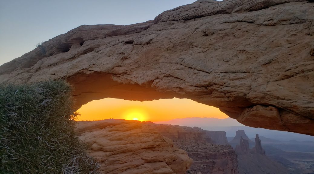
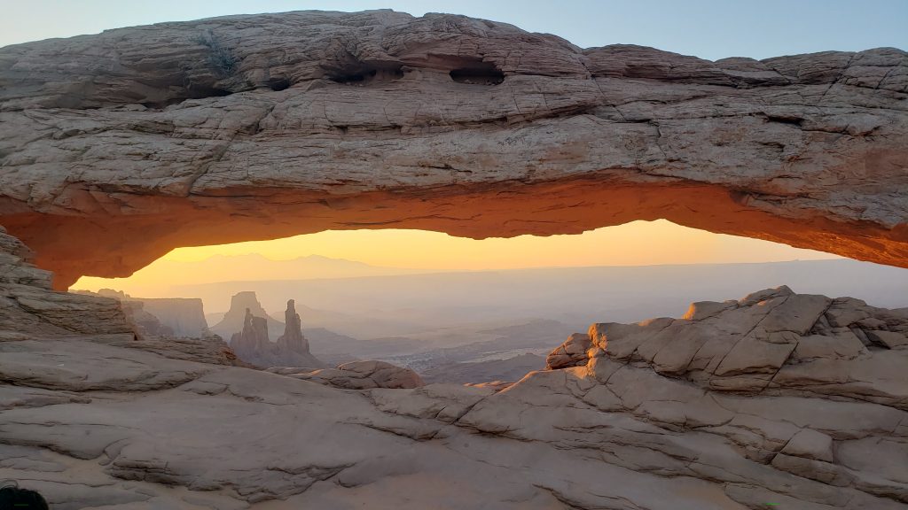
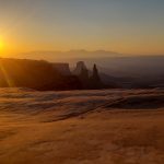
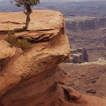
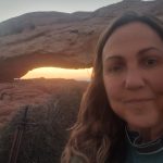
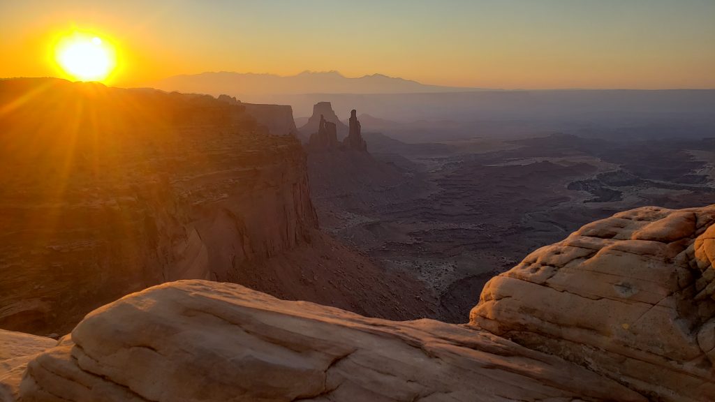
I got up early, very, very early, Monday morning to get to the park for sunrise. I woke at 4, dressed, walked Boo for about 20 minutes, then drove the one hour to Mesa Arch. It is located in the Island in the Sky or ISky area of the park. There were already about a dozen people there at the end of the 1/2 mile trail when I arrived about 0530. Many more arrived while we waited for sunrise, a few minutes before 6. I took too many photos. When I was able to review I removed about half right away. But you never know which ones are going to look good! Mesa Arch is a gorgeous view with or without sunrise.
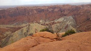
After enjoying the view and sunrise for about 1/2 hour, I returned to my car and continued my drive south. I took the road northwest to Upheaval Dome. I stopped at Whale Rock and did that short one mile trail. The road ends at Upheaval Dome. There are two scenic overlooks, one about half mile from the trailhead the second another half mile further. Both have beautiful views. At the first overlook, you can see the crater, there are two theories about this, an old sea bed with salt deposits that have collapsed or a meteor impact.
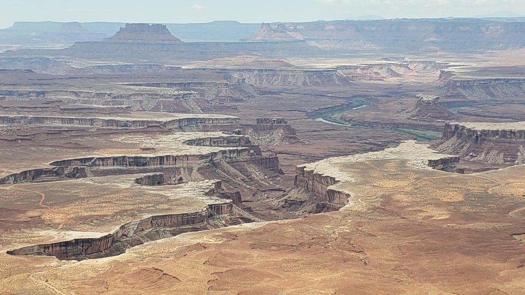
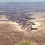
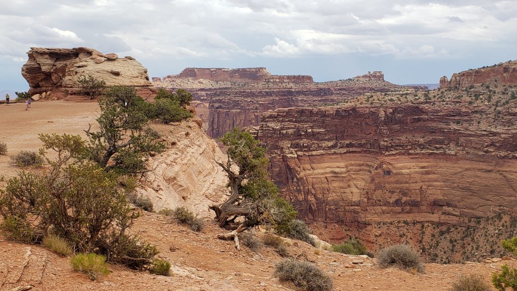
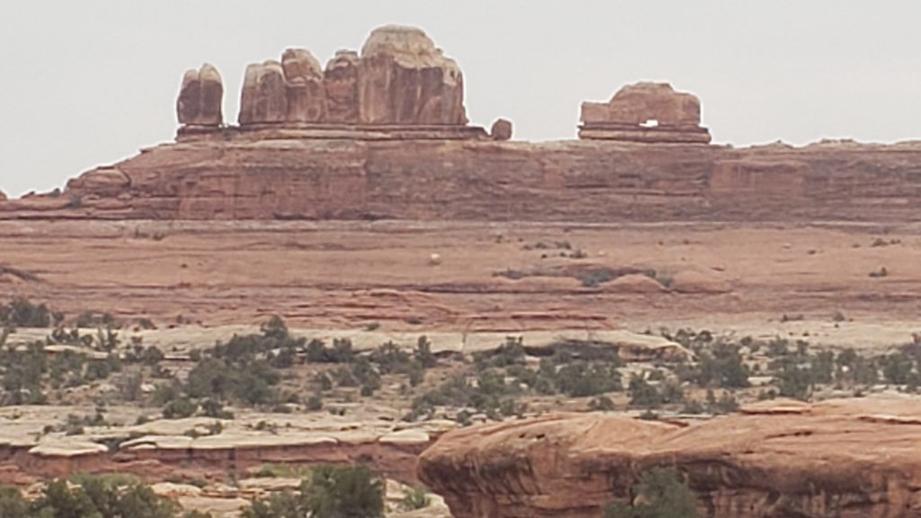
I returned to the main road, stopping at Green River Overlook before continuing south on the main scenic drive all the way to Grand View Point Overlook. Stunning.
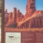
I returned to the visitor center and stopped in for a map and to view the exhibits. Like many other national parks, the store was open but the exhibits were blocked off. There doesn’t seem to be much consistency with the park visitor centers. There were two rangers out front answering questions and passing out the park brochures. It was after 10 and I had an hour drive back so left the park for a nap!
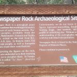
My second day in the park I visited The Needles. It is about 70 miles south of Moab and takes about an hour and a half to get to the visitor center. I left early Wednesday; I was on the road by about 0620 and arrived just after 0800. I stopped by Newspaper Rock to see the petroglyphs. 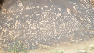 I already had my brochure and Needles map and trail guide from my visit Monday but stopped at the visitor center to see if the exhibits were open or the video showing. Like the visitor center in ISky, only the store is open but I spoke with the Ranger out front for about 10 minutes about the trails and roads.
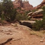
I stopped at the Roadside Ruin, a 0.3 mile trail to a small structure built by indigenous peoples, then continued to the end of the main road at Big Spring Canyon Overlook. The 10 mile trail to the Confluence Overlook (where 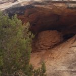 the Green and Colorado Rivers meet) starts here. I did about a mile along the path before returning to the Slickrock Trailhead. This is a 2.4 mile trail with some great viewpoints. It is only marked with rock cairns.
 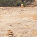 This is why it is so important for visitors and hikers to not build their own or destroy existing cairns. I would have been wandering for days here without those markers. This trail offers four great viewpoints. I really loved this walk, it was beautiful.
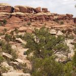
After finishing this great trail, I headed back up the road and stopped to do the short, 0.6 mile, Pothole Point. This trail is also marked by cairns and offers great views of the Needles.
I turned down the road leading to Elephant Hill. The ranger told me that although unpaved, it was packed dirt and safe for low clearance cars. I wanted to see this area so took the drive toward the campgrounds then drove 3 miles on the dirt road to Elephant Hill. The road is narrow and has lots of blind curves, I only passed two cars. One was going way too fast for conditions and had to swerve and skid to a halt when he came around a curve right at me. Drive carefully!
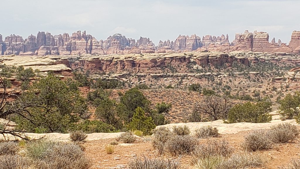
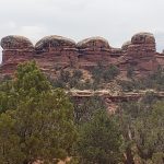
Elephant Hill has some great formations. Many of the longer backcountry trails start here including Devil’s Kitchen, Druid Arch, and Lost Canyon. Most of the trails are 6 to 11 miles and take from 3 to 7 hours to complete.
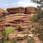
I just climbed the hill for some great views then returned to the road. At the ranger’s suggestion, I did take the short road to Campground A for the scenery. Finally, I took the southern loop of the main road to get to the start of Cave Spring Trail. This is another unpaved road, just about a mile and much easier than the drive to Elephant Hill.
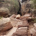
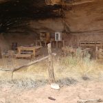
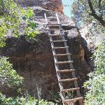
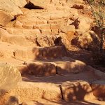
Cave Spring is another very short, less than a mile, mostly easy trail. There are two ladders to climb and it can be difficult to get off the ladders up the rocks if you had any fear of heights. But it was a fun walk, I got to see an old cowboy camp, petroglyphs, and more on this beautiful little trail.
Slickrock, Pothole Point, and Cave Spring all had trail guides available to provide information on the viewpoints or other features. They are at the start of each trail and ask for a 50 cent donation. I put a dollar in one but returned all 3 guides. Reduce, REUSE, and recycle. I think many others did the same as some of the guides weren’t folded correctly. 🙂 I spent about six hours in the park doing these trails. The longer trails sound great, they would just need more preparation, and, for me, a different time of year.
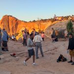
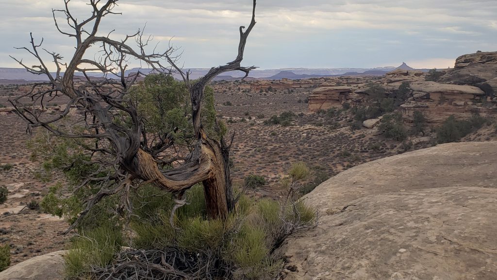
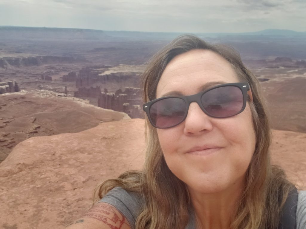
I returned to the park a third day, back to Island in the Sky to do a few additional hikes. I drove directly to Grand View Point and did the 2 mile hike there. I am not sure “Grand” does this justice. Spectacular? Unbelievable? Jaw-dropping? Great trail. When returning to the overlook, there was a ranger there about to start a talk on Big Horned Sheep. I stayed for the 15 minute talk, learning that there used to be about 2 million sheep in the area. Ranchers, mining, climate change all had an impact on their population. They thought the sheep went extinct in the 1960s but have found about 350 in the park; zoologists are monitoring the herds.
Back up the road, I stopped at White Rim Overlook and Buck Canyon before heading to Upheaval Dome to do that walk again and get some photos of the “meteor crater” (or collapsed salt dome?). It rained slightly between the first overlook and second overlook. This is already a difficult trail, hard to follow the cairns over the rocks, the drizzle made the rocks pretty slick so I only walked about halfway to the second overlook. On the way back to the main road, I stopped at the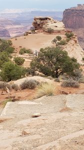 Green River Overlook again and checked out the Aztec Butte trail. It is another 2 mile trail but I didn’t do the entire trail. On the way out of the park, I stopped at the Shafer Overlook, for more stunning views of the park.
Notes:
** This quote was in my National Geographic National Parks book, the chapter on Canyonlands. I liked the quote but being curious, looked up the quote and the name of Edward Abbey. After reading the Wikipedia article his Desert Solitaire book sounds interesting, but, Abbey? Not so much.
Ironically, while I had never heard his name, after reading this quote, I noticed a book in my AirBNB called “Resist Much, Obey Little: Some Notes on Edward Abbey” about his writings. After just paging through this book I need to give him another look beyond Wikipedia. Even the intro says ‘to conservatives his views are dangerously left-wing, to liberals, his opinions carry dreaded overtones of self-sufficiency, “elitism”, and other “bugaboos”.’ Clearly a complex individual, ‘not a guru or a crank’
** all photos property of Lisa, not to be copied or reproduced **