Big Bend National Park
Big Bend National Park: Mountains and deserts and rivers, oh my!
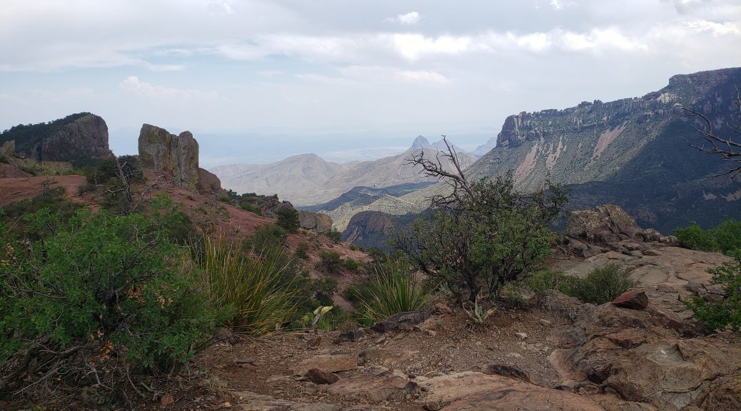
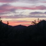
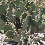
Chisos Mountains, Chihuahuan Desert, and the Rio Grande make up the diverse and beautiful landscape of Big Bend. I’ve never been here, so when planning the next stage of my travels, I looked at the map and thought, I need to visit Big Bend!
This is not a park that is easy to get to and it’s not highly visited. The ten most visited national parks range from the Great Smoky Mountains with over 12M visitors to 2.4M at Joshua Tree. Big Bend gets less than half a million and, as the website states, you have “splendid isolation”.
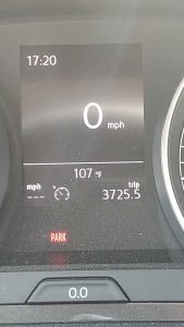 The ranger I spoke with the first day said his favorite month in the park is October, “beautiful perfect weather” but said the busiest time was March for all the desert blooms. It stays busy until about mid-April. Low-season is, often, quite nice in many places. You have less crowds and the prices are frequently better for lodging. In the case of Big Bend, it’s all about the weather. May is not the best time to visit as it’s already quite hot. I was here from May 25 to May 29 and every day was high 90s with one day up to 101. Temperatures like this make hiking a lot less enjoyable. My car showed 107 on the drive back to the cabin Friday. It’s MAY! All the rangers told me that May and June are actually hotter than July and August.
I had planned 3 days for the park. I was staying at Terlingua Ranch “Lodge” about 30 miles west of the west entrance. I selected it because it was one of the few places I could have dogs. It was 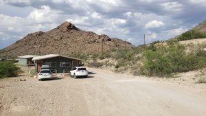 a much longer drive than I expected from the map and estimated mileage. It is 16 miles off Texas-118 and the last 3 on a gravel road. It made for long days just coming and going from the park. The cabin I had was okay but I really hated that drive, it seemed longer every time I took it. I was so glad to take my final drive on Saturday as I headed north to Carlsbad. If you don’t have a dog, stay at the lovely Chisos Lodge in the park or a hotel in the town Study Butte Terlingua, right outside the park.

Rio Grande Village
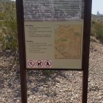
Wednesday I arrived early at the park, before 8. I was going to go to the Chisos Visitor Center but they had road closures so I continued to Panther Junction. I showed my park pass as requested at the entrance station, then picked up a permit for my car, a map, and the park paper, the Paisano. The Paisano is a great reference with all the trails listed and detailed maps of the three major visitor areas.
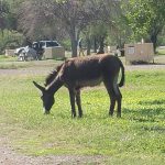
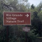
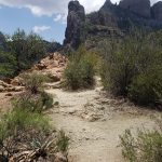
I decided to drive to the Rio Grande Village area at the far southeast corner. The visitor center there is not open but I drove to the village campgrounds to start the Rio Grande Village Nature Trail. There were some donkeys and wild horses grazing in the campground. I had seen a couple javelinas, the wild pigs, run across the road on the drive over, too. The nature trail is short, less than a mile, and beautiful, leading through ponds and marshes over some bridges. If you go up the hill there is a slightly longer overlook loop trail for views of the river.
I stopped and did the Boquillas Canyon Trail next, another beautiful area. The trail is about a mile and a half, climbing up and over a hill to a sandy beach by the river. I walked a short way down the canyon before returning. I was serenaded by a Mexican right across the river and left him some money in the jar on the US side, for “singing Jesus”.
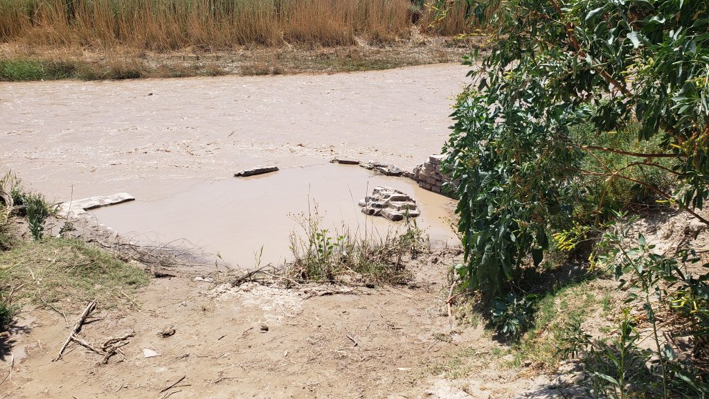
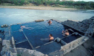
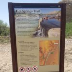
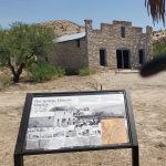
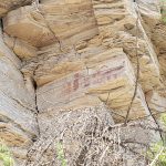
After Boquillas, I drove to Hot Springs. The springs were flooded but I wanted to see the old houses, anyway, and did a short hike. The road back there, like many in the park, was gravel and narrow. There are buildings left from when people came to the springs for their potential healing power. The area has been occupied for 1000s of years and you can also see some rock art.
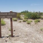
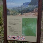
Heading back west, I stopped at Dugout Wells and did the Chihuahuan Desert Trail, another short easy trail. It has interpretive signs throughout the loop.
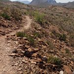
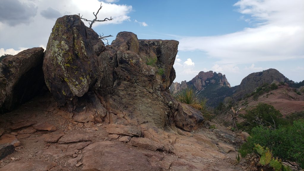
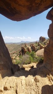 Finally, at the end of the day, I stopped at the Grapevine Hills for the Balanced Rock Trail. This is a long drive, about 7 miles, down a gravel road, to do a 2.2 mile hike. Only in national parks, right? The trail is mostly easy.
 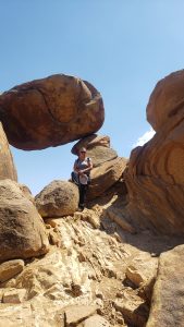 It’s flat until you get to the last half mile or so, then you have some climbing over large rocks.
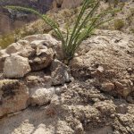
I didn’t think the trail really well marked at that point. I went up a large rock fall and down the back of the hill and returned to the top before finding some other hikers coming from the right. I finally found the balanced rock; I would have been disappointed on returning without seeing it. It is a beautiful location.


Ross Maxwell Scenic Drive
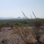
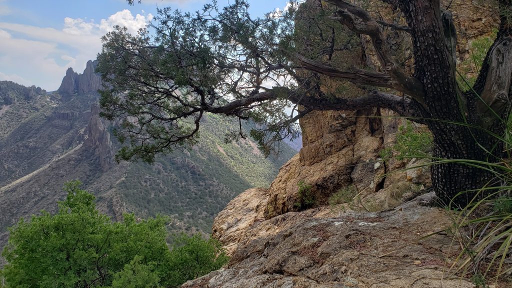
Thursday I drove into the park and headed south and west down the 30 mile Ross Maxwell Scenic Drive, named for the first superintendent of Big Bend. The drive is truly scenic.
I drove all the way to the end, without any stops, to the Santa Elena Canyon as I wanted to do that trail first. I get there and walk several hundred yards down the trail and see the Terlingua Creek crossing which is supposedly “usually dry” flowing with water.
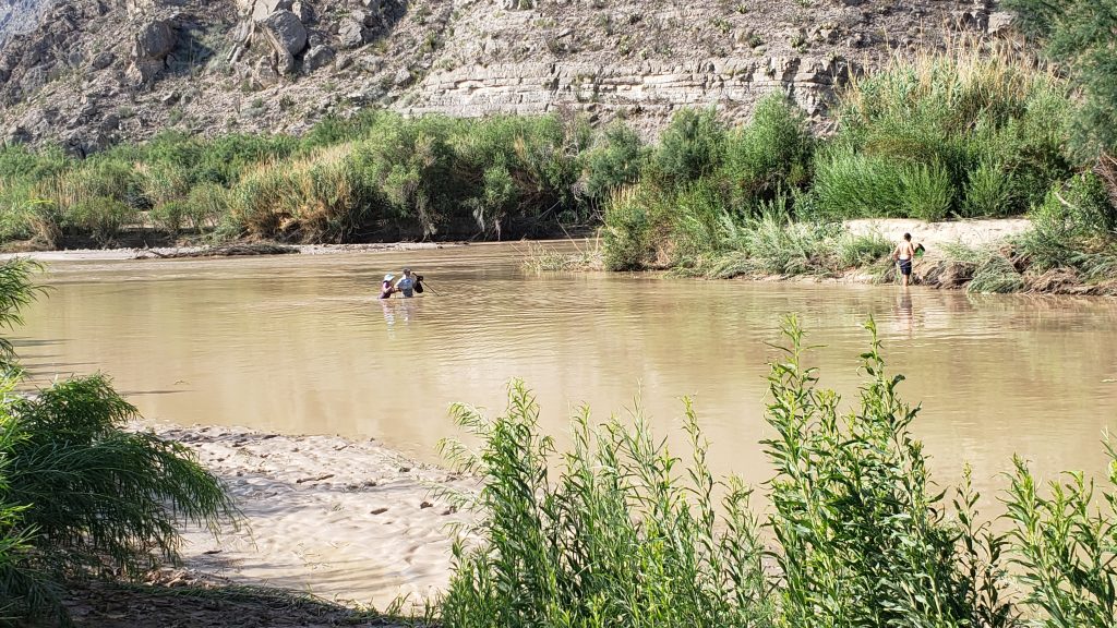
There was a guy in shorts walking through water up to his waist holding his belongings over his head. Another man, leading a lady, were also crossing the creek. I thought, no way. The trail is supposed to be beautiful but didn’t think it worth wading across that dirty muddy water. The guy standing next to me as we both watched these avid hikers, turned to me and said “there are a couple snakes in the water just upstream”. Definitely, no.
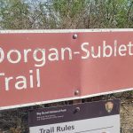
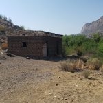
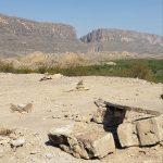
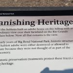
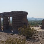
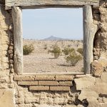
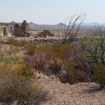
So I walked along the creek both north and south to look at the canyon then went back to my car and drove to the Dorgan-Sublett Trail. I had already stopped at the Santa Elena overlook just up the road for a great view of the canyon and river.
The Dorgan home, the Sublett farm house, and several other buildings and ruins are accessible from the trail.
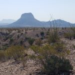
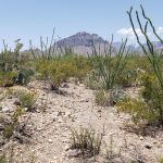
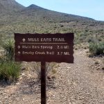
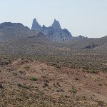
I stopped at the Mule Ears Viewpoint and then did just about 1.2 mile of the 3.8 mile round trip on the Mule Ears Spring Trail. It is easy and flat, but hot, hot, hot and NO shade. I did get great views of the Mule Ears and the desert.

I went to the Lower Burro Mesa Pour-off Trail; this is about a mile round trip, into a dry wash. Beautiful and peaceful. I was the only one there but 3 other vehicles arrived as I was returning to my car. I stopped at the Sotol Vista for some truly amazing views over the desert. My last trail of the day was another short easy trail, the Sam Nail Ranch, almost an oasis in the desert. There are two old windmills at the Nail’s old ranch site.
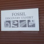
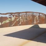
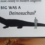
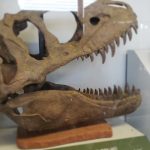
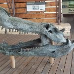
It was still early in the day, so I drove east to visit the Fossil Discovery Exhibit. This is about 9 miles north of Panther Junction Visitor Center on the road to Marathon. This is a fairly new exhibit, opened in 2017. It takes you through 130 million years of history. It has a “Boneyard”, fossil replicas, great art and information.
Chisos Basin
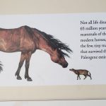
On Friday I drove to the park planning to go directly to Chisos Basin but arrived too early, before the road was open at 11, so went back out to the Fossil Discovery area. I really enjoyed that exhibit and reread all the info on the various time periods, and amazing creatures that lived, including the 39-foot super crocodile or deinosuchus, and the tiny horses.
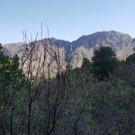
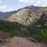
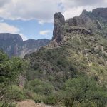
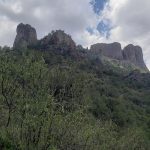
A little before 11 I went to the road to Chisos. There were about 20 cars ahead of me, and another 8 pulled in behind before the gate opened. I should have just waited 1/2 hour or so. Following all those cars in meant I stayed in second all the way to the Chisos Basin. But going that slow allowed me to gawk at the gorgeous scenery on the drive. I parked by the visitor center then spoke with a couple volunteer rangers about the trailheads here. The Basin Loop, Emory Peak, South Rim, Window and Window View Trails all start behind the Basin Store.
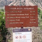
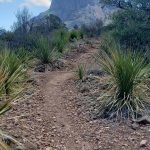
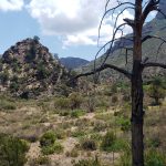

I wanted to do the Basin Loop Trail, two miles, with great views of the Basin area. It connects the longer Pinnacles and Laguna Meadow Trails. It has about 350 feet of elevation so pretty easy. The trails are well marked and easy to follow.
Finishing the Basin Loop, I did the short, paved Windows View. This is where they recommend watching the sunset. I was going to do the Windows Trail starting at the campground instead of the store, but the rangers told me the parking at Lost Mine fills up and I may want to do that before Windows.
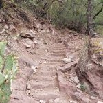
Lost Mine Trail is about 5 miles round-trip but the park paper recommends doing one mile “for a great view to the southeast”. I drove down to the start, parked and started the trail intending to just do that first mile. But I just kept going. It was so beautiful; I wanted to see what was around the next switchback and soon I was about 2 miles in and thought, well now I have to finish! The views just kept getting better. This was my favorite trail in the park. I finished and went straight down without stopping, getting back to my car around 5. I skipped the Windows Trail and left the park driving back to my cabin for the evening.
General Info
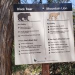
Pets are not allowed on any of the trails, so Boo stayed at our cabin all 3 days. I felt bad about leaving him alone but I know he was much happier there in a cool cabin with his big bed and a cold bowl of water.
There were other activities I would have enjoyed if I had stayed longer, including a rafting trip. And if the weather was better, there were longer trails I would have like to try.
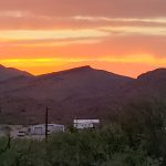
I definitely recommend staying closer to the park, or, even better, inside the park. It would have allowed me to see the sunsets and some of the Dark Sky events.
Restaurants
My friend, Melanie, who lives in Irving, Texas sent me this Yelp listing the top 100 Texas restaurants. I had already left Austin and San Antonio so didn’t try those restaurants but saw DBs Rustic Iron BBQ in Study-Butte Terlingua on the list and thought, I will try that when in town. I stopped in Wednesday after leaving the park and got a brisket plate with slaw and beans. All of it was very good, especially after a long day of hiking, it really hit the spot. I shared some of the beef and the fatty trim with Boo, he was quite pleased!
I also tried Chili Pepper Cafe, after asking the lady at Cottonwood Store for a good Mexican place where I could get some to-go food. They were also in Study-Butte Terlingua on the way back to my cabin. I picked up some shredded beef empanadas, with a salad and side of beans on Friday.
I didn’t eat out any other times, mostly just snacking in the park. I had a 3 pound bag of mandarins, packaged cheese and crackers, and peanuts. I didn’t see many places inside the park to buy food except at the Chisos Basin store and I was told there was a restaurant in the Lodge.
It may sound odd, but the guy at Terlingua Ranch Lodge front desk recommended the breakfast sandwiches and burritos at the ALON gas station. When stopping for gas (which I did EVERY day… there is a lot of driving in the park!) I picked up a bacon, egg, cheese burrito twice when heading to the park. They even had homemade salsa. Quite good.
I never did try the Bad Rabbit Cafe on the ranch. I went in Wednesday morning before leaving for the park. I was going to order an egg sandwich for the drive, and they told me they had no cook that day. They are hiring, if interested!
** All photos property of Lisa, not to be copied or reproduced **
3 thoughts on “Big Bend National Park”
Hello There. I found your blog the usage of msn. That is a really well written article. I will be sure to bookmark it and come back to read extra of your useful info. Thank you for the post. I’ll definitely return.
Thank you, so nice to hear!
Thanks for finally writing about > Bigg Bend National Park –
"Tourists don't know where they've been. Travelers don't know where they're going." < Loved it!